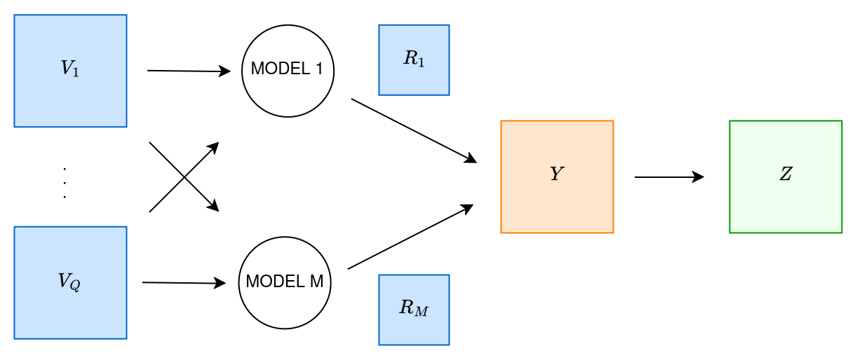
<?xml version="1.0" encoding="utf-8"?><feed xmlns="http://www.w3.org/2005/Atom" ><generator uri="https://jekyllrb.com/" version="3.10.0">Jekyll</generator><link href="/feed.xml" rel="self" type="application/atom+xml" /><link href="/" rel="alternate" type="text/html" /><updated>2026-10-24T06:31:15+00:00</updated><id>/feed.xml</id><title type="html">Margaret Hansen</title><subtitle>Personal website for Margaret Hansen, Robotics PhD candidate at Carnegie Mellon University.</subtitle><entry><title type="html">Physical Process-Informed Mapping</title><link href="/ppim/" rel="alternate" type="text/html" title="Physical Process-Informed Mapping" /><published>2024-10-01T00:00:00+00:00</published><updated>2024-10-01T00:00:00+00:00</updated><id>/ppim</id><content type="html" xml:base="/ppim/"><![CDATA[<p>Large-scale information maps are highly useful when using mobile robots to explore unknown regions for path planning. In order to generate such maps, predictions must be made based on low-resolution and/or sparse observations of scientific data, which are extrapolated to unobserved regions with some expected uncertainty. Predictions can be improved by integrating other correlated variables, as has been shown in <a href="https://robotics.estec.esa.int/i-SAIRAS/isairas2016/Session4c/S-4c-3-GreydonFoil.pdf">Foil et al. (2016)</a>, in addition to incorporating non-stationary effects and correct modeling of sensor noise.</p>

<p align="center">
<img style="float: center; margin-top=30px; margin-bottom=30px;" src="/assets/ppim_flowchart.png" width="70%" alt="Flowchart showing relationship between natural phenomenon, sensor observations, and physical process models and variables." />
</p>

<p>This project posits that integration of physical process models, such as equation-based representations of natural phenomena, can further improve the predictive capabilities of maps of natural phenomena. In addition, inclusion of such process models should enable analysis of the relevance of each model to such predictions, assisting with scientific investigations into these phenomena. This research investigates such improvements to large-scale mapping for mobile exploration robots and will make up my dissertation research.</p>

<p><strong>Papers:</strong></p>

<p>M. Hansen, R. Elphic, T. Fong, and D. Wettergreen, “Improving Predictive Modeling for Robotic Resource Mapping with Non-Stationary Process Effects and Sensor Noise Estimation,” 2024 International Symposium on Artificial Intelligence, Robotics and Automation in Space, Brisbane, QLD, Australia, 2024 (forthcoming).</p>]]></content><author><name></name></author><summary type="html"><![CDATA[This project posits that integration of physical process models, such as equation-based representations of natural phenomena, can further improve the predictive capabilities of maps of natural phenomena. In addition, inclusion of such process models should enable analysis of the relevance of each model to such predictions, assisting with scientific investigations into these phenomena. This research investigates such improvements to large-scale mapping for mobile exploration robots and will make up my dissertation research.]]></summary></entry><entry><title type="html">Spectral Mixture Ergodic Search</title><link href="/sm-es/" rel="alternate" type="text/html" title="Spectral Mixture Ergodic Search" /><published>2023-09-01T00:00:00+00:00</published><updated>2023-09-01T00:00:00+00:00</updated><id>/smes</id><content type="html" xml:base="/sm-es/"><![CDATA[<p><img style="float: right; margin-left: 30px;" src="/assets/cuprite_opal_iter12_slow.gif" width="30%" alt="GIF of changing ergodic trajectory on learned map." /></p>

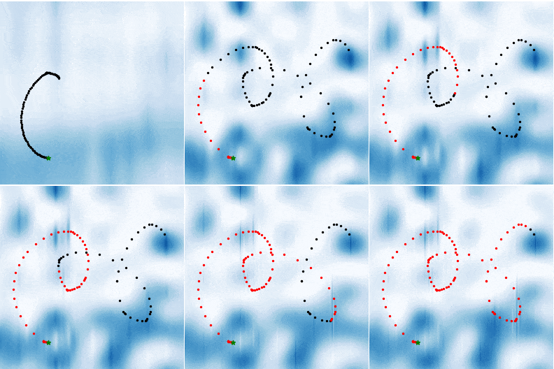
<p>Spectral mixture kernels are covariance kernels for methods such as Gaussian process regression that are capable of theoretically learning any stationary covariance structure by representing the inverse Fourier transform of the kernel as a Gaussian mixture model. Ergodic search likewise relies on Fourier decomposition to compute the loss metric used in its optimization procedure, typically relying on a pre-determined set of frequencies and knowledge of the information distribution over which search is to occur. This project seeks to use the Fourier decompositions present in both methods to link the two such that as a spatial distribution is learned via Gaussian process regression with spectral mixture kernels, the ergodic search algorithm is adapted to use the frequencies found to be important for describing the distribution.</p>

<p><strong>Paper:</strong> M. Hansen, A. Rao, A. Breitfeld, and D. Wettergreen, “Resource Mapping with a Mobile Exploration Robot using Spectral Mixture Ergodic Search,” 2026 International Conference on Robotics and Automation (ICRA), Vienna, Austria, 2026 [forthcoming].</p>]]></content><author><name></name></author><summary type="html"><![CDATA[This project pairs mapping methods that rely on spectral mixture kernels with ergodic search such that as a spatial distribution is learned via the former and used to generate trajectories via the latter. This pairing is made possible via the Fourier decompositions used by both methods, enabling the ergodic search algorithm to be adapted to use the frequencies found to be important for describing the distribution by the mapping method.]]></summary></entry><entry><title type="html">Lunar NeRFs</title><link href="/lunar-nerf/" rel="alternate" type="text/html" title="Lunar NeRFs" /><published>2023-06-01T00:00:00+00:00</published><updated>2023-06-01T00:00:00+00:00</updated><id>/lunarnerf</id><content type="html" xml:base="/lunar-nerf/"><![CDATA[<p><img style="float: right; margin-left: 30px;" src="/assets/nerf_view_env3.png" width="30%" alt="Render of lunar terrain from a NeRF model." /></p>

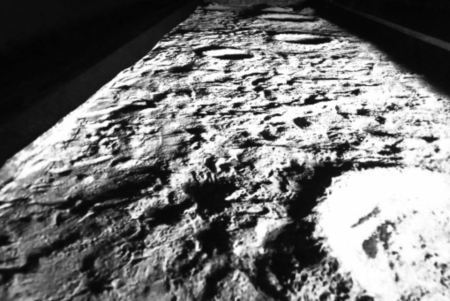
<p>Neural radiance fields (<a href="https://www.matthewtancik.com/nerf">NeRFs</a>) are learned, neural representations of a density and color field that can be used to render novel views of a scene via volumetric rendering. These techniques are a hot topic in the graphics community, but questions abound about their applicability to mobile robotics. Some algorithms capable of online learning of a scene have been proposed (see <a href="https://edgarsucar.github.io/iMAP/">iMAP</a> and <a href="https://github.com/ToniRV/NeRF-SLAM">NeRF-SLAM</a> for examples), but these are very new methods that model room-scale scenes and require high-quality GPUs. Planetary robotics poses a challenge for such techniques due to the often extreme lighting conditions, lack of features in a scene, and limited motion of the image sensors, in addition to the problem of compute. This project seeks to assess the practicability of using NeRFs for modeling lunar terrain, with a focus on geometric aspects in addition to photometric.</p>

<p><strong>Paper:</strong>
M. Hansen, C. Adams, T. Fong, and D. Wettergreen, “Analyzing the Effectiveness of Neural Radiance Fields for Geometric Modeling of Lunar Terrain,” accepted at IEEE Aerospace Conference, Big Sky, MT, USA, 2024.</p>

<p><strong>Dataset:</strong> 
This work uses data published in the <a href="/datasets/">POLAR Traverse Dataset</a>.</p>]]></content><author><name></name></author><summary type="html"><![CDATA[Neural radiance fields (NeRFs) are learned, neural representations of a density and color field that can be used to render novel views of a scene via volumetric rendering. Planetary robotics poses a challenge for such techniques due to the often extreme lighting conditions, lack of features in a scene, and limited motion of the image sensors, in addition to the problem of compute. This project seeks to assess the practicability of using NeRFs for modeling lunar terrain, with a focus on geometric aspects in addition to photometric.]]></summary></entry><entry><title type="html">Range-based GP Maps</title><link href="/range-gps/" rel="alternate" type="text/html" title="Range-based GP Maps" /><published>2023-03-01T00:00:00+00:00</published><updated>2023-03-01T00:00:00+00:00</updated><id>/rangegp</id><content type="html" xml:base="/range-gps/"><![CDATA[<p><img style="float: right; margin-left: 30px;" src="/assets/rover_graphic.png" width="30%" alt="Graphic of rover observing terrain with associated uncertainty and range measurement projected onto sphere." /></p>

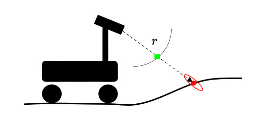
<p>This project represents range measurements from a Velodyne LiDAR scanner using Gaussian process regression to model the surrounding environment in a sensor-centric frame based on the angles used to take a range measurement. The goal of doing so is to represent 3D features - such as caves, vertical walls, and overhangs - in a way that incorporates spatial correlation, produces uncertainty predictions, and is continuous. GPs lend themselves to this application well but must be used to model the correct value (range).</p>

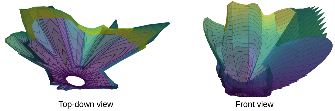
<p>GP regression is typically only applied to elevation, especially in the context of planetary rovers. Elevation-based models work well for orbital images, since the sensor noise is well aligned with the terrain height. However, for a ground-based rover, perception sensors will record data at an oblique angle to the terrain, meaning the sensor uncertainty also has components in the x and y directions. Range-based Gaussian process maps model range measurements directly as a function of the inclination and azimuth of the ray along which an observation was taken, enabling correct modeling of uncertainty along with incorporation of spatial correlations. Work has thus far focused on local mapping over simulated cratered terrain and for subterranean data (example below).</p>

<p><strong>Paper:</strong> M. Hansen and D. Wettergreen, “Range-based GP Maps: Local Surface Mapping for Mobile Robots using Gaussian Process Regression in Range Space,” 2023 IEEE/RSJ International Conference on Intelligent Robots and Systems (IROS), Detroit, MI, USA, 2023, pp. 7241-7248, doi: <a href="https://doi.org/10.1109/IROS55552.2023.10341949">10.1109/IROS55552.2023.10341949</a>.</p>

<center>
<img src="/assets/local_range_maps.png" width="90%" alt="Example of local range-based GP map, top-down and front views." />
</center>]]></content><author><name></name></author><summary type="html"><![CDATA[This project represents range measurements from a Velodyne LiDAR scanner using Gaussian process regression to model the surrounding environment in a sensor-centric frame based on the angles used to take a range measurement. The goal of doing so is to represent 3D features - such as caves, vertical walls, and overhangs - in a way that incorporates spatial correlation, produces uncertainty predictions, and is continuous. Initial results were presented at IROS 2023.]]></summary></entry><entry><title type="html">MoonRanger</title><link href="/moonranger/" rel="alternate" type="text/html" title="MoonRanger" /><published>2022-08-01T00:00:00+00:00</published><updated>2022-08-01T00:00:00+00:00</updated><id>/moonranger</id><content type="html" xml:base="/moonranger/"><![CDATA[<p><img style="float: right; margin-left: 30px;" src="/assets/morphin.jpg" width="30%" alt="Prototype rover in test bed with rocks." /></p>

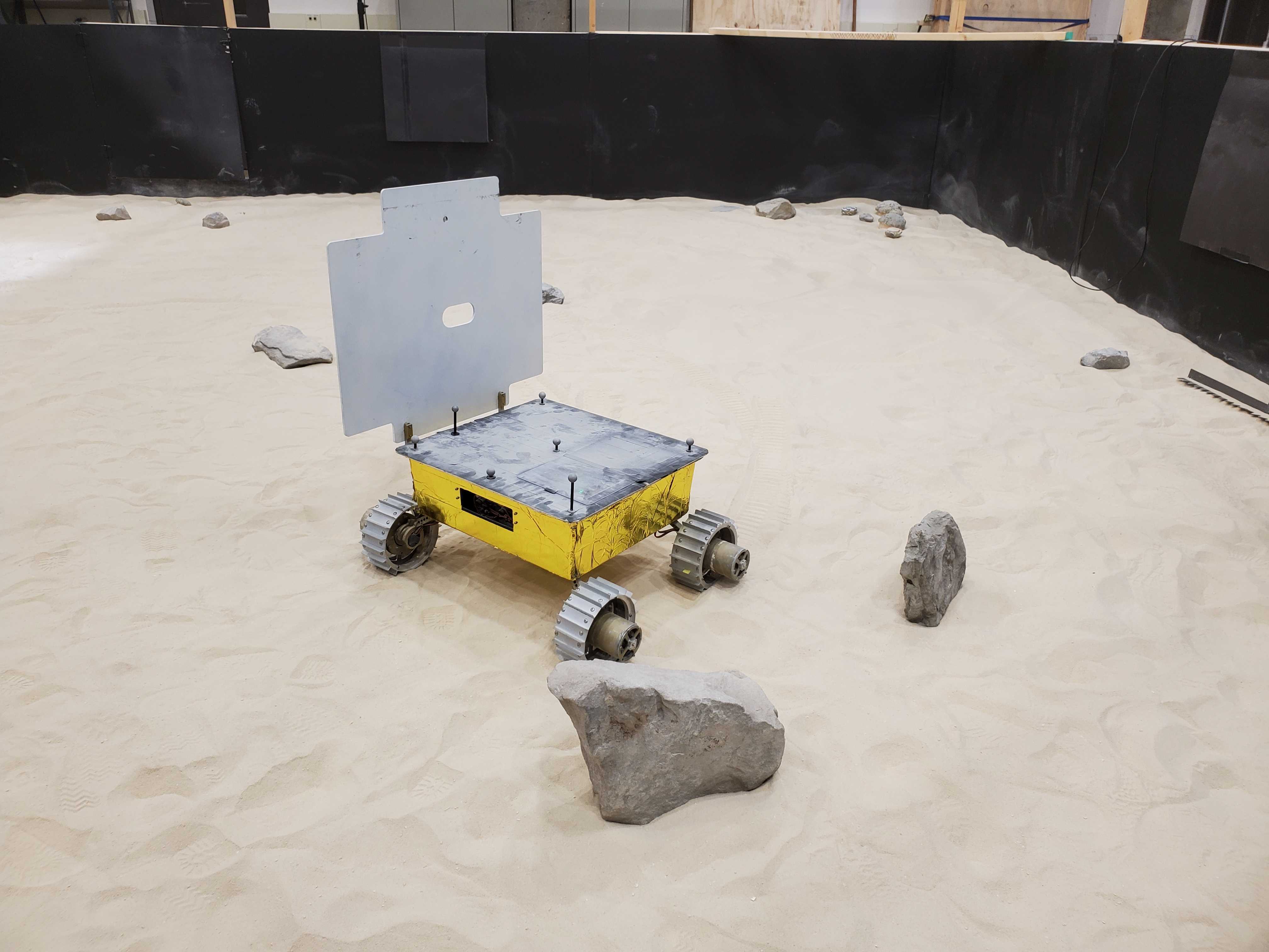
<p><a href="https://labs.ri.cmu.edu/moonranger/">MoonRanger</a> is a microrover designed by Astrobotic and CMU to search for volatiles (ice) at the south pole of the moon. The rover is roughly the size of a suitcase and carries a neutron spectrometer as its payload, in addition to a solar panel that deploys at a 90 degree angle due to the low incidence angle of sunlight in the polar regions. MoonRanger is equipped with two pairs of stereo cameras, one in front and one in the rear, to be used for navigation, along with infrared laser dot projectors for use in shadowed regions. The rover is designed to autonomously traverse to waypoints of scientific interest and return to the lander, and is expected to survive for 2 weeks (one lunar day) on the surface of the moon.</p>

<p>I designed, authored, and validated the mapping component of the flight software for MoonRanger. The terrain mapper relies on stereo cameras to produce disparity images, which are then used to generate terrain meshes based on where edges are found in the depth images of a scene. Edges are generally observed at the horizon line, as well as along the tops or borders of obstacles (rocks) due to the presence of occlusions. Points determined to be along edges are kept at a higher rate to ensure correct modeling of these important features. Meshes are accumulated as the robot moves based on the pose estimate, with a set maximum radius and number of vertices used to remove points from the model if either constraint is violated. The terrain models generated by this mapper have been compared to a dense ground-truth scan produced by a FARO scanner while static and driving to confirm they represent the geometry of the terrain to an acceptable degree of accuracy.</p>

<p>In addition to my role developing the mapping software, I am also an active participant in integrated testing of the autonomous navigation software on a prototype rover (shown above). This testing occurs in the Moonyard test bed in the Planetary Robotics Lab at CMU and has included using motion capture systems to track ground-truth location of the robot, running the prototype rover through repeated loops around the test bed with different rock formations, and of course debugging software issues on the fly.</p>

<!-- (testing) -->

<!-- The mapping software is based on older designs that rely on terrain meshes, with improvements such as edge detection in disparity images to ensure higher preservation of points of interest. Integrated testing occurs in the Moonyard test bed in the Planetary Robotics Lab at CMU and has included such diverse tasks as using motion capture to track ground-truth location of the robot, validating the mapping system against dense ground truth information produced by a FARO scanner, and performing repeated iterations of parameter modification and testing. -->

<!-- As part of this project, I designed, authored, and tested the mapping component of the flight software, in addition to being an active participant in integrated testing of the autonomous navigation software on a prototype rover. The mapping software is based on older designs that rely on terrain meshes, with improvements such as edge detection in disparity images to ensure higher preservation of points of interest. Integrated testing occurs in the Moonyard test bed in the Planetary Robotics Lab at CMU and has included such diverse tasks as using motion capture to track ground-truth location of the robot, validating the mapping system against dense ground truth information produced by a FARO scanner, and performing repeated iterations of parameter modification and testing. -->]]></content><author><name></name></author><summary type="html"><![CDATA[A microrover designed by Astrobotic and CMU to search for water ice at the south pole of the moon. As part of this project, I designed, authored, and tested the mapping component of the flight software, in addition to being an active participant in integrated testing of the autonomous navigation software on a prototype rover.]]></summary></entry></feed>